Photos available here
After our day off in Kingman, we pushed our loaded bikes on the famous Route 66 towards Williams, about 220 kilometers to the East, before taking a sharp turn 2North and get to the Grand Canyon. After visiting the Grand Canyon, we would track back to Williams and Kingman, doing the exact same road, on the other way. If only the riding would have been as simple as writing those first two sentences…
After having a not so glorious continental breakfast at the Travelodge, clouds covered Kingman as we left, menacing with rain. Luckily, the heavens held up. Mild wind in our faces, we pushed up the false flat for about 2 hours. We passed a group of 4 elderly cyclists; all Chinese. They started from LA, heading into Chicago to cover the legendary road at length, before veering south towards Florida, across the US again and into Central America and South America. They were on folded bikes with baggage hanging out here and there. The oldest at 70 years old, was the better-organized one. With the help of Google translate, we could have brief discussions went we stopped for breaks.
We pushed to Hackberry, a popular stop along road 66. The temperature was barely reaching 10 degrees Celsius once up there. Everyone seemed to stop in this gift shop in the middle of nowhere. As we came to a stop, the rain started to fall. We leaned our bikes on the giant log at the front of the shop and realized that Tiph’s back tire was flat. Our first puncture on this trip was caused by broken glass, most likely coming from one of the thousands broken bottles, mostly beer, found along the road. Something that most people don’t see from the seat of their cars is the litter along the road, despite clear road signs forbidding to with fines reaching $750. I moved Tiph’s bike under the roof to protect us from the rain, unloaded her bike, pulled out my repair kit and started to work. Seated on a 4 wheeler dragging an empty small trailer, a worker comes by and tells us we needed to move immediately. This was a tourist spot and we polluted the view, preventing passers-by from their precious photo without beaten down cyclists being part of the frame. Without offering his help, we pressed on the throttle and left us. We moved on the side, exposed to the rain and swapped the tube on Tiph’s rear wheel. Our hands were frozen cold when we left the place behind but the rain had stopped, finally.
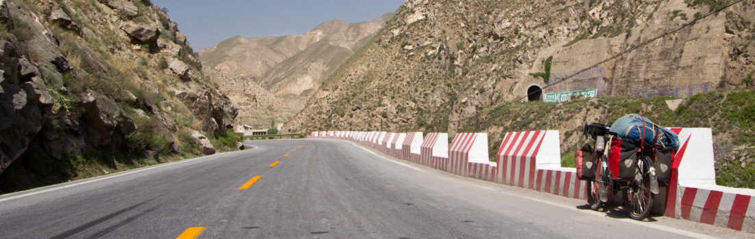
The road was up and down as we crossed the Cottonwood Cliffs, with climbs longer than the descents. The road was relatively busy and the shoulder nonexistent for most of the way. It was sketchy and we used prudence until we reached the top and descended towards Truxton, the last town before the Hualapai Indian Reservation. The slope was between 1% and 3% downwards, but we had to pedal in order to reach 14 km/h. The wind was fierce, slowing us down. Going in the opposite direction, 4 police cars and an ambulance zipped by, flashes on. I turned back to Tiph and said: “Jeez, I hope this is not for our Chinese friends!!”. We sat at a petrol station, just before the entrance of Truxton. It was time to look for camp so we topped our bottles. The young man working at the store came to say hi and inform me that a cyclist got hit by a car just up the road. Back outside, a truck was parked beside Tiph. The couple inside was just informing her that 2 cyclists got hit by an SUV. He confirmed they were Chinese. Not long after they left, we pondered on this sad news when another truck pulled by us to also inform us about the news. According to him, our fellow cyclists were injured and brought to Kingman’s hospital. The man strongly suggested to not keep going forward on the Reservation this late in the day because many drivers take the wheel under the influence.
They sometimes pull over the gas station and because they are so intoxicated, they can’t even walk out of their cars. He suggested to track back about a mile and there will be a gate allowing access to a dirt road on private property. In this region, landowners allowed anyone to enter their land as long as they follow the rules mentioned on the sign hanged on the gate. We would be able to find a rare tree under which we could camp, away from the road, which we did.
The wind was still coming from the East when we woke up. We couldn’t catch a break. We climbed another 530 meters while descending 260. We cycled through the picturesque Aubrey Valley before arriving into Seligman, dead tired. Trees seemed to grow exclusively around houses, not in the wild. And barbed wired fences blocked access to the fields, making the search for camp more difficult than we anticipated. We settled under a small bridge just passed Seligman. At last, a small break from the blowing wind.
Many have informed us; “the climb to Williams is like this!”, raising their arm at a 45% angle towards the sky They could have been saying “Heil Hitler!”, and the gesture would have been similar. Even trucks were slowing down as they went up. Some even mentioned we would pass them as we went up. I doubted that and we were about to find out. Route 66 ended at the junction with Highway 40 on which we could cycle on the shoulder, about 2 meters wide. Apart from the noise generated by traffic, cycling was going well. Ho, and the wind. I almost forgot. It was still blowing our helmet off. We started the climb and took our first break after about 30 minutes. Tiphaine turned around to grab her click stand only to realize it wasn’t there anymore. Another event to add to our growing unlucky list of events since we started. The gradient increased to reach a constant 5-7% over several kilometers, I can’t tell. The temperature dropped as we went up, but the sun was out, warming us up a little. We were way past 2000 meters high when we took an exit into town. After the last couple of hard days, we treated ourselves to camping so we could benefit from hot showers before the push to the Grand Canyon the next day.
The only road leading to the south rim of one of the seven natural wonders is the 64, the road we nicknamed hell’s road after the first few kilometers. The shoulder was anything between nonexistent to about 30 centimeters wide, one lane on each side, tarmac condition was appalling, speed limit set to 65 miles per hour and considering the popularity of this site, the traffic was heavy with all sort of vehicle. It is amongst the most dangerous road I have put the rubber on. After about 15 kilometers, we had enough of this madness. Google Maps showed a dirt road leading to a network of roads in the mountains leading to Valle, a small town about midway to the Grand Canyon. Most of these roads were private property, like the signs indicated on fences we passed. We were only passing through. Surely, there wouldn’t be any problem! The dirt road transformed into a track, we took a right turn into a single lane. Consulting my trusty friend Google Maps, a left turn lead to another road to join Valle. We missed the turn because, well, the road hasn’t been used for a long time, the tracks covered by the sand and overgrown grass and plants. Eventually, we rejoined something that looked like a trail, leading us to a dirt road. All around us were red cliffs and behind us, Mount San Fransisco with its snow-covered peak was on display. There weren’t any cars and were saved. It was a thousand times better than hell’s road.
We came into Valle at the end of the day. There was a petrol station with several gift shops where tourists bus stopped before the Canyon. Across the street, an abandoned Flintstones themed RV park was left to decay. At one end, 2 natural gas-powered bus were parked, tires half pumped, their green paint started to peel off. Just beside, a tall pine tree and a picnic table provided for a camp for the night. We collapsed in bed after a well-earned dinner.
The alarm was set at 5 the following morning. From Valle, there was only one way to the Grand Canyon; Hell’s road. We wanted to beat the traffic and get to the small town of Tusayan as fast as possible. From there, we knew we could take a bus shuttle to the Grand Canyon village, another 15kms away. The sun was barely up that we were packed and ready to go. We were nervous every time a vehicle passed by, but in general, the drivers behaved extremely well and took the other lane to overtake us. By mid-morning, we were purchasing our Grand Canyon pass in Tusayan and loading our bike on the bus shuttle towards this bloody Canyon.
After pitching our tent on a hiker-biker campground, we finally laid eyes on the legendary crevasse naturally formed millions of years ago. It lived to its name. It was certainly Grand and wowed us instantly. We spent the remaining of the following day walking the rim of the Canyon, a good change of pace from the cycling. We decided to book a train back to Williams and not risk our lives on Hell’s road again and we treated ourselves to a second day off to do some bike and gear maintenance, sort photos and recharge some of our electronics. With the winds blowing in our faces on the way to Williams, we couldn’t wait to get back on the road, this time back towards Kingman with the wind on our tail. Unless it turned around…
