As opposed to what we expected, we spent 4 busy days in Mexico City; an entire day at the Museum of Archeology, an amazing lunch at the best barbacoa place Mexico with my friend Denisse which lasted 3 hours followed by a long walking around the Plaza de la Constitucion, a full day at Teotihuacan archeological site and on the last day we took 3 hours trying to ship a box back home before heading to the street full of bike shops trying to find parts we needed. In between all of that, we had our bikes serviced, had dinners with our Warmshower hosts David and Alba, researched the route going forward and enjoyed some beers in the evening.
Eventually, time would come when we needed to leave. Our route out of CDMX (Mexico City’s code for locals) took us straight to the South before heading West. Most of the way on bike paths which worked out very well, I must say (thanks to David!). It was on a small road following a canal on the outskirts of Mexico City we hit 5000 kilometers mark. We paused to take a photo and commemorate the precious moment.


Our route took us to Amecameca, at the base of two volcanos; Iztaccihuatl at 5230 meters and Popocatépetl standing at 5426 meters, the latter still active. So much activity is occurring that the road going between them is often closed for weeks due to ash and toxicity in the air. Villages are occasionally evacuated due to the danger this beast is causing. Marie, the French cycle-tourer we cycled with back in Baja, couldn’t take the road due to closure. A couple of weeks after it re-opened, the same time we decided to go up. The culmination of this road is called Paso de Cortés, where a view of both craters is possible in the morning before the clouds roll in during the day.
Named after the well-known Conquistador who seized Mexico, Hernan Cortés, the pass sits at 3692 meters above sea level. Wikipedia mentions 3400 meters, but my Garmin and Omsand (an application we sometimes use for our routes) showed 3692 meters. It is believed that, in 1519, Cortés leads his men to the pass in order to reach the Valley of Mexico. A legend tells the tales of few of Cortés men climbed up Popocatépetl, down the crater and came back with sulfur to make gunpowder.
In an early evening in Amecameca, we were lucky to see Popo, affectionately called by the locals, shoot its ash in the air. We were all excited to witness our first active volcano but it was nothing compared to the following day.

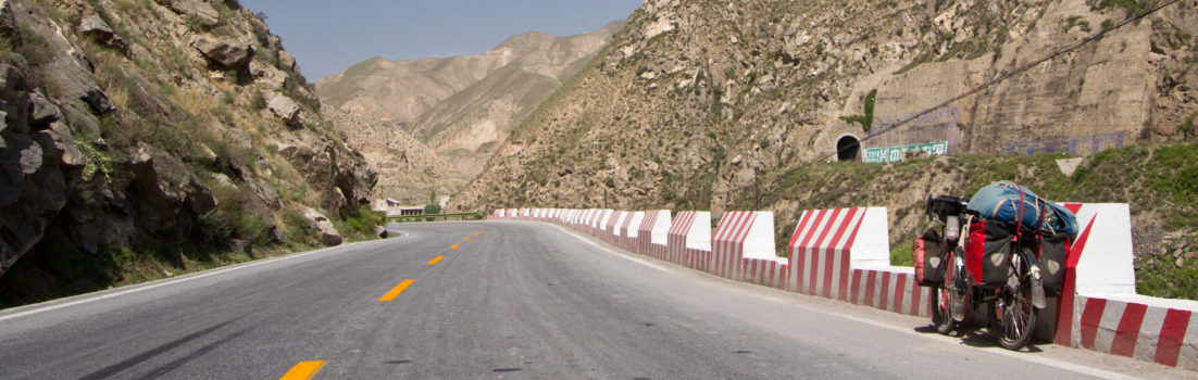
The following morning we took off in air still damp and cold from the early morning rain. The sun was up but wasn’t a real good job of warming us up. We rode a few kilometers on the main road before turning left toward the pass. As soon as we turned, the incline route started and we were off for nearly 1200 meters of climbing. The road went through sugarcane fields, villages, and men on horses. Not much traffic apart from the minibusses linking Amecameca and the villages often jammed with people.
Soon, gradients were steady at 9% and we were sweating bullets. The sun was out, but not for long. We were about to reach the clouds, giving us protection from this fusion ball in the sky. We just passed the last village and the traffic was thin.
We passed a horse tied to a tree and not far, his owner was cutting sugarcane with a machete, seemed surprised to see us. We took a quick pause to catch our breath and drink water as the man approached us. He introduced himself as Oscar before bombarding us with the typical questions.


Waving goodbye to this gentlemen, we kept on grinding up the steep hill now reaching gradients between 12-15%. Sugarcane fields were quickly replaced by pine trees and restaurants is made up shelters on the side of the road, most closed probably because we were mid-week.
The temperature started to drop and gave us chills in our wet clothes. We climbed on a road surrounded by thick forest obscured by a thin mist. Volcanoes were nowhere to be seen, but a minivan driver coming down stopped to say hello and practice his English. He assured us the weather was clear up there. So we kept on pushing and hope he was right.
After several hours of climbing, we emerged above the clouds where the sun rays warmed us again. We turned a corner of the mountain and there it was. Popo in all his glory. Tiphaine say it first as she exclaimed “Hey, look on the right! It’s the volcano!” Few seconds after we stopped to admire the conical shaped mountain through clear weather, fumes of ash came up its crater. We were both in awe, like two kids. It was the first time we both witness an active volcano erupting.

A few meters later, Iztaccihuatl and its snow-capped peaks appeared in between the tall pine trees on our left. The sudden sight of both volcanos on clear weather gave us the strength to push the few kilometers remaining. Once in awhile, views of either Popo or Izta amazed us and we couldn’t wait to get to the pass. Before we knew it, the view in front of us was cleared of trees and seemed to touch the blue sky. We had finally arrived at the pass, pretty tired. We took a photo with the sign and rolled our bikes in front of Popo which was so closed, we could barely touch it. Every spew of ash or clouds were like magic.
There is an information center at the pass with facilities and 24/7 police surveillance. We spotted a few places to camp not too far from the building and we decided to pitch our tent for the night. While cooking dinner, dark clouds rolled in over Popo and threaten our perfect plan of having a quiet dinner over volcano activities. Instead, we quickly ate, packed up and found refuge in our house now that Popo was hidden by thick clouds.

Next morning saw frost on the ground and a small dog sleeping on my entrance mat. During the night we heard its ears flap a few times, between the coyotes’ howls, as it shook its head. I unzipped the door and the volcano was in its full glory on a blue sky backdrop. The small dog, shaking like a leaf, didn’t want to move as I stepped out to take a photo of our camp with the volcano in the background.


I returned to the tent and we started our morning routine of packing and preparing breakfast when our little friend decided to move on my sleeping mat to take a nap. I could feel his fragile bones as I patted him. Poor little thing, we thought. We gave him a few bits of bread which he devoured in seconds as well as some water. That seemed to make the other of his kind jealous as two more dogs approached with their pity eyes. They seemed in much better shape so we deemed them not worthy of anything.
After we packed, the descend started on a good quality dirt road but quickly degraded within the first kilometer. For most of the first 14 kilometers, the road was a mix of rocks and destroyed surface with bumpy sections. We passed sandy bits as well, but the views of Popo all along were nothing short of spectacular. It took almost 3 hours to descend where the asphalt started and by the time we got there, our hands were burning red and hurt like hell. But from there, it was downhill all the way to Cholula. The heat was back, the cold night and early morning frost was behind us, just like the Paso de Cortés and the two giant mountains now simply part of the landscape.
