This is the third and last article about our time on the Nicoya Peninsula.
Our first 10 days on the Nicoya Peninsula were marked by steep and challenging steep sections and superb beach riding, camping by beaches and being kicked off by police officers and celebrating NYE in Samara, a popular ex-pat town on the peninsula. I go in more details in the first part and second part of this series of 3 articles, so I would recommend reading those before continuing on.
After a great night sleeps at the back of Locos Cocos restaurant, right by San Miguel beach, we pushed our rigs through the sand for a short section of beach riding. Waiting for us that day was a flat-ish route to Playa Coyote, our next stop. The southern part of the Peninsula sees much fewer travellers, a good thing for us. Finally, a little break from heavy traffic and dust. We were pleased to discover it was free to use the campground at Playa Coyote. We only had to pay for amenities. For the better part of the afternoon, we admired the view and chilled before crossing the 2 large rivers the following morning. Apart from the track of their tires on the road, there were no signs of our friends until after sunset when their headlamps give them away. They were stationed on a nearby beach for most of the afternoon when 2 men arrived during sunset. Looking suspicious and dodgy, Aaron and Emily decided to pack and come to a safe place for the night.

The following morning we were out of our tent by 6, gearing up for the day. I was looking forward to the river crossings while Tiph was a little anxious, maybe because of the presence of crocodiles in those rivers. I reassured her that at low tide, chances were little of coming face to face with one. Our first stokes brought us at the top of yet another hill before descending on the flat ground leading to the river crossings. With water coming up to our knees, we pushed the bicycles steadily traversing the rivers without many efforts. On the second river, I went across to set the camera to take photos as we walked across. We needed to immortalize this much-anticipated part of the journey!


Following the second crossing was a long stretch of spectacular beach riding which could only be done at low tide. There is a section with rocks which becomes impassible at high tide. For the better part of an hour, we leisurely pushed our pedals on compacted sand, scaring crabs as we passed by.
At the end of the beach, we embarked on a single track road following the ocean. Devoid of vehicles, our shoes soaked and sandy like never before, we cruised on the best part of the Peninsula so far. By mid-afternoon, we approached Santa Teresa town, the most popular in this part of the Peninsula. With it came to traffic, ATVs going at alluring speed and the bloody dusty roads again. As we closed the town centre yoga retreats, cafes, restaurants and boutiques lined up the main road. There was dust everywhere yet people sat on terraces, sipping coffee or having lunch. How can they enjoy being in this dust storm, we did not know. We set our aim was a campground a little before Malpais. For the first time since leaving that morning, we saw Aaron and Emily, who just arrived at Alimar campground. It was full of tent and people so they decided to settle at a campground a little further down the road. We took the rest of the afternoon to dry some of our soaked gear and relax by the sound of the ocean crashing on the rocky beach.


The following day was our last on the Pacific side as we crossed a mountain range at the southern end of the Peninsula before arriving along the Gulf of Nicoya. The track led us in beautiful lush jungle, small river crossing and ridiculously steep hills, in the 30% this time. Imagine you are cycling on a 15% gradient when suddenly appears a wall as if you were on a flat surface, you know it’s steep. We helped each other pushing the bicycles up and it was hard going. But there wasn’t any cars, nor dust, making for a more enjoyable experience.
We took a quick break after descending in Cabuya, a quiet and lovely town on the fringe of the Gulf of Nicoya. We passed a huge, tall ceiba tree. This kind of tree, common in Central America, engulfs other trees by wrapping their branches around and outgrowing them. This particular one was the largest tree in Costa Rica. We continued on to Montezuma, the busiest town on the East coast of the Peninsula. Filled with yoga retreats, cafes, restaurant and whatnots, it was much quieter than Santa Teresa. Waiting for us at the end of town was you guessed it, a hill. We had lunch midway up so we could split it in two.


We rolled on the busy main road for a little while before veering right into a track going through farmland. It was a pretty section with stunning views of mountains, the ocean showing itself between trees and not much climbing, for once. The track eventually led us down to the waterside and quickly became a trekking path in the jungle, but still navigable with loaded bikes. As red macaws flew above our heads, we passed one beach after another, families of howler monkeys and spider monkeys jumping trees in the canopy and dodge our way between tall lianas.
At the end of the path was Playa Tambor where we elected to spend the night. There was a large public park with tables and looked like a nice place to camp. We watched the sun go down as Aaron and Emily walked toward the beach. They made it too! They arrived earlier and were offered a room in a hostel if Aaron agreed to play American country music at dinner for guests. Being a musician, he agreed on the spot. We talked for a little before we prepared dinner and pitched our tent. We were so knackered after a long and difficult day that we fell asleep as soon as we hit the pillow.


The following morning we woke up with items missing; our sandals, Tiph’s hat, towel bikini bottom were gone. That didn’t start the day too well. Tips got over it quickly, but not me. After losing my GoPro and having my shoes stolen earlier, this act of theft had a stronger effect on me and I started to get irritated with losing or having our things stolen. After reflection, this public park was, in fact, the worst place to camp. Not hidden, everyone could see us hence making it easy for someone with bad intentions to simply grab stuff as they pass by as we sleep. Never again, we told ourselves.
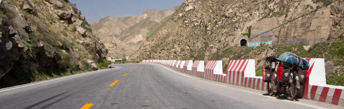
The long-awaited tarmac was welcomed as we started our second last day on the Peninsula. Again, steep climbs were part of our day but we had become used to it by now. Only this time, the brand new asphalt made it “easier” for us. The soft carpet under our wheels wouldn’t last as the dirt and dust reappeared once passed Paquera, on the other side of the Gulf. We were doing groceries at Pali when Aaron passed by closely followed by Emily. It would be the last time we see each other as they took the ferry to Puntarenas while we kept on cycling around the Peninsula. We hugged and said goodbye before we disappeared in a dust cloud. Luckily though, there was much less traffic compared to our first days but the mercury showed 40 degrees Celcius. It felt like Baja once again and without shade, it was tough going. After yet another set of steep hills, we arrived at a small hamlet where a restaurant had camp spots available, right by the water. The beer that night tasted better and was more satisfying than anything else we’ve had on this journey. We collapsed in bed not long after dinner, watching the sun disappear behind the hills for one last time on the Nicoya Peninsula.


We were up earlier the following morning, light barely illuminating the sky. It was our last day in this beautiful part of the world. We knew there were hills ahead of us and we didn’t want to climb under a searing sun. We gulped down breakfast, packed up and got going early. Quickly, the last set of steep hills were behind us. At the top a magnificent view of the Gulf with the mountains in the background waited for us, rewarding us after all the efforts. We flew downhill and reached Playa Naranjo in no time. With it came permanent asphalt, flat terrain and tailwinds carrying us toward our next stage on this journey; the central highlands and Lago Arenal.


More photos available in the Costa Rica Photo Gallery
NICOYA PENINSULA SUMMARY
The Nicoya Peninsula route is mostly on dirt roads, steep hills and could be extremely dusty. I would not recommend it for beginners for cycle-tourers with fully-loaded bicycle mostly because of near-impossible steep hills on loose dirt and rock. However, it is a fantastic route for bikepacking of any level. The heat could be unbearable by midday and everything is more expensive than anywhere else in the country.
Camping under a tall palm tree on underdeveloped beaches stretching for miles, dipping in the warm Pacific waters, the chance to witness sea turtle hatching or nesting, riding on jungle paths where howler monkeys and red macaws watch you pass by and riding on the hard, compacted sand right on the beach are only some of the highlights.
We followed the Gira Costa route available on bikepacking.com, from Liberia to the Amistad bridge. The GPX file from the other route, “Nicoya Peninsula Dirt Road Odyssey”, proved to be harder to follow on our routing applications but essentially is the same. There was only one section we couldn’t follow around Playa Junquillal because the road had been taken away by floods during the last wet season. For more about the route, visit bikepacking.com.
